New Hampshire Atlas
Online Atlas > New Hampshire > Museums • Photographs
New Hampshire facts and history plus travel and tourism information.
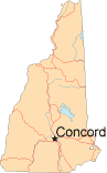
Capital: Concord
Abbreviations: NH (postal), N.H.
Area: 9,283 square miles
State Bird: Purple Finch
State Tree: White Birch
State Flower: Purple Lilac
State Motto: Live Free or Die
Nickname: The Granite State
When New Hampshire was discovered by English Captain Martin Pring in 1603, Abenaki and Pennacook Native Americans lived there. However, Europeans who settled in the region twenty years later brought smallpox and other European diseases, which wiped out most of these natives.
As one of the original thirteen colonies, New Hampshire was the deciding vote for ratifying the United States Constitution. New Hampshire entered the Union as the ninth state on June 21, 1788. Every four years, New Hampshire holds the first state primary elections in the nation as the Democratic and Republican parties begin to select their candidates for the United States presidential election.
New Hampshire's terrain ranges from impressive mountains to lakes, rivers, and thirteen miles of coastline. Lake Winnipesaukee is one of the largest freshwater lakes in America, and the city of Portsmouth benefits from its location by the estuary of the Piscataqua River. In recent years, however, shipbuilding, maritime trade, and fishing have been taken over by light and technology industries.
New Hampshire Map
New Hampshire Links
- New Hampshire Government - official New Hampshire state website.
- New Hampshire Division of Travel & Tourism Development - New Hampshire travel and tourism.
- National Parks in New Hampshire
- New Hampshire QuickFacts - from the US Census Bureau.
- 50States.com - New Hampshire
New Hampshire Resources
- New Hampshire Real Estate - real estate information about New Hampshire.
- New Hampshire Colleges and Universities - higher education institutions in New Hampshire.
- New Hampshire Libraries - list of libraries in New Hampshire.
All rights reserved.
For your convenience, each external link will open in a new window.