Map of Rhode Island
Online Atlas > Rhode Island > Map of Rhode Island
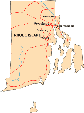
Rhode Island is bordered by Massachusetts to the north, by Connecticut to the west, by Block Island Sound and the North Atlantic Ocean to the south, and by Massachusetts to the east.
Leading cities on the map of Rhode Island include Providence and Pawtucket.
A more detailed Rhode Island road map, with numbered highways and scenic route information, can be found on this map website.
Copyright © 2007-2024 Zeducorp.
All rights reserved.
All rights reserved.