|
|
|
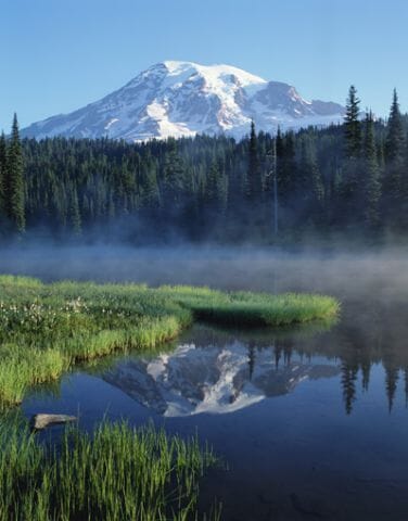
Situated on the west side of the Cascades in Washington State, Mount
Rainier is the highest volcano of the range and the 5th highest mountain
in the contiguous forty-eight states. The Yakima Indians originally
named it Tahoma, meaning "Great Snowy Peak," an apt name for the
14,410-foot mountain which is capped with snow year-round.
Twenty-six named glaciers carve into its rocky slopes. To
acknowledge and preserve its natural beauty, President William McKinley
designated 235,625 acres in the region as Mount Rainier National Park on
March 2, 1899. About 2 million people visit annually; the peak is
especially attractive to climbers for its beautiful snowy conditions.
Mount Rainier
• Washington - Find travel information, maps, tourist resources, and more photos of Washington.
• Mount Rainier - Learn about this Washington park at the official National Park Service website.
Copyright © 2006-2026 Zeducorp.
All rights reserved.
Mount Rainier National Park
|
