Indiana Atlas
Online Atlas > Indiana > Museums • Photographs
Indiana facts and history plus travel and tourism information.
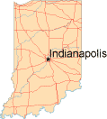
Capital: Indianapolis
Abbreviations: IN (postal), Ind.
Area: 36,420 square miles
State Bird: Cardinal
State Tree: Tulip Tree
State Flower: Peony
State Motto: The Crossroads of America
Nickname: The Hoosier State
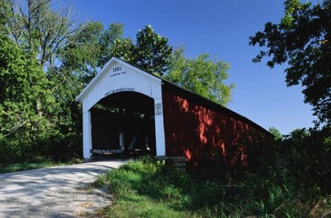
Sim Smith's Bridge, Indiana
Indiana means "land of Indians," a reminder of the many Native Americans who lived on the land before "Hoosiers" became the more common name for Indiana residents. No one knows for sure where the nickname "Hoosier" came from, but there are many theories.
Indiana became the 19th state on December 11, 1816, and has since become a major player in the manufacturing and agriculture industries. Indiana companies produce auto parts, steel, electronics, medical equipment, chemicals and more. In flat northern Indiana and on the rolling hills in the southern part of the state, farmers grow corn, soybeans, and hay and raise pigs, dairy cows, and chickens.
Indiana is home to three nationally distinguished educational institutions - Purdue University, Indiana University, and Notre Dame. Indianapolis, the capital city, lies in the center of the state and hosts the famous Indianapolis 500 race. Other attractions include the Children's Museum of Indianapolis and the Indiana Dunes National Lakeshore along Lake Michigan.
Indiana Map
Indiana Links
- Indiana Government - official Indiana state website.
- Visit Indiana - Indiana travel and tourism.
- National Parks in Indiana
- Indiana QuickFacts - from the US Census Bureau.
- 50States.com - Indiana
Indiana Resources
- Indiana Real Estate - real estate information about Indiana.
- Indiana Colleges and Universities - higher education institutions in Indiana.
- Indiana Libraries - list of libraries in Indiana.
All rights reserved.
For your convenience, each external link will open in a new window.