Iowa Atlas
Online Atlas > Iowa > Museums • Photographs
Iowa facts and history plus travel and tourism information.
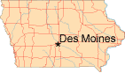
Capital: Des Moines
Abbreviations: IA (postal), Ia.
Area: 56,276 square miles
State Bird: Eastern Goldfinch
State Tree: Oak
State Flower: Wild Prairie Rose
State Motto: Our Liberties We Prize and Our Rights We Will Maintain
Nickname: The Hawkeye State
Iowa added vast prairies to the United States by becoming the 29th state on December 28, 1846. Covered by around 33,000,000 acres of farmland, Iowa produces the most corn, soybeans, and pork in America and hosts the country's largest state fair. With the Missouri and Mississippi Rivers on two of its borders, this "breadbasket of the Midwest" attracted German, English, and Irish immigrants during the 19th century. German Protestants from Buffalo, New York still live in the Amana Colonies, one of Iowa's largest tourist attractions.
Iowa's climate ranges from long, bitter cold winters to hot, humid summers, although spring and fall are more pleasant. Many of the state's towns preserve the "Main Street USA" image, and Grant Wood's "American Gothic" painting illustrates Iowa's conservative, rural heritage. Every four years, the Iowa caucuses commence the process of nominating Democratic Party and Republican Party candidates for the quadrennial United States Presidential election.
Iowa Map
Iowa Links
- Iowa Government - official Iowa state website.
- Travel Iowa - Iowa travel and tourism.
- National Parks in Iowa
- Iowa QuickFacts - from the US Census Bureau.
- 50States.com - Iowa
Iowa Resources
- Iowa Real Estate - real estate information about Iowa.
- Iowa Colleges and Universities - higher education institutions in Iowa.
- Iowa Libraries - list of libraries in Iowa.
All rights reserved.
For your convenience, each external link will open in a new window.