Online Atlas
Online Atlas > US Museums | US Picture Gallery
| Online Atlas State Pages | ||||
|---|---|---|---|---|
|
Alabama Alaska Arizona Arkansas California Colorado Connecticut Delaware Florida Georgia Hawaii Idaho Illinois Indiana Iowa Kansas Kentucky |
Louisiana Maine Maryland Massachusetts Michigan Minnesota Mississippi Missouri Montana Nebraska Nevada New Hampshire New Jersey New Mexico New York North Carolina North Dakota |
Ohio Oklahoma Oregon Pennsylvania Rhode Island South Carolina South Dakota Tennessee Texas Utah Vermont Virginia Washington Washington, DC West Virginia Wisconsin Wyoming |
||
| Geographic, historic, and tourism information about the 50 USA states and Washington, DC | ||||
An atlas is a collection of general reference maps, thematic maps, and geographical information. Detailed maps are often displayed to advantage in printed atlases, but online atlases can benefit from the interactive nature of the World Wide Web. These online map and atlas websites may include scrollable maps and customizable graphs as well as searchable content and downloadable statistics. This online atlas features maps, photographs, and information about the United States of America.
Map of United States
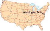
The United States is a diverse and interesting place, filled with unique cities, beautiful landscapes, and historical points of interest. OnlineAtlas.us is an online travel atlas and information guide that introduces you to this influential country by providing facts and trivia as well as pictures and maps about each American state.
The city of Washington, in the District of Columbia, is the nation's capital. The White House, Supreme Court, and Congress are located here, and the city is a tourist destination as well. Many government departments and agencies are based in the Washington, DC area. Information about Washington, DC is also available on this atlas website.
 United States Capitol Building, Washington, DC
Travel Resources
- Recreation.gov - find outdoor recreational activities in each state.
- National Park Service - atlas of national parks and monuments.
- USDA Forest Service - features information about national forests.
- National Weather Service - find weather and climate information.
- Bureau of Land Management - overview of America's public lands.
- America's Byways - find scenic roads and byways in your local area.
- USA Map - United States road maps, topo maps and relief maps.
- World Atlas - World map plus continent maps and country lists.
USA Directories
- State and County Facts - US Census Bureau data about people, business, and geography.
- Regional Directory - USA business and other organizations, arranged by state and category.
- State Map Directory - road maps, topographical maps, and relief maps of US states.
- Higher Education Directory - colleges and universities in the United States of America.
Bibliography
- Baird, L., Brousseau, M., and Rose, A. (2008). Fifty States: Every Question Answered. New York: Metro Books.
- de Blij, H. J., Editor (2006). Atlas of the United States. New York: Oxford University Press.
- Weiss, S. E., Project Editor (2005). Atlas of America: Our Nation in Maps, Facts, and Pictures. Pleasantville, New York: Reader's Digest.
All rights reserved. About Us. Contact Us
For your convenience, each external link will open in a new window.
Maps Copyright © 2005 Map Resources.